Subsurface Detection & Utility Mapping
Non-destructive Ground Penetrating Radar (GPR) services to trace pipes, cables, and conduits. Prevent costly strikes, damage, and excavation project delays.
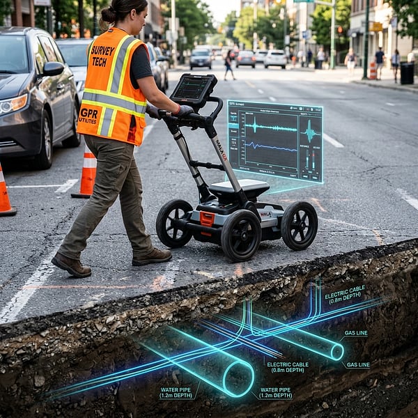
Ground Penetrating Radar & Cable Detection
Civil excavation, architectural digging, and plant expansions face extreme risk from underground utilities. Striking a water main, high-voltage cable, or fiber optic trunk can halt works, cost millions in fines, and threaten lives. TerraX3D provides advanced Subsurface Utility Engineering (SUE) services to map under-surface conditions before you break ground.
Dual-Frequency Radar Capture
Emitting active electromagnetic pulses to reflect underground utility boundaries down to 4.5m.
Advanced Locating Applications
SUE Utility Auditing
Non-destructive tracing of clay, PVC, copper, and fiber pipes before starting mechanical excavation on commercial B2B building sites.
Electromagnetic Line Tracing
Tracing active power cables, telecom trunks, and pipelines using induction signal receivers.
Concrete Rebar Scanning
High-frequency radar to detect embedded rebar grid lines, post-tension cables, and void cracks inside concrete structures.
Subsurface Mapping Deliverables
2D / 3D CAD Utilities
Mapped underground utility routes exported directly to AutoCAD DWG or GIS spatial coordinate databases.
Void & Cavity Profile
Erosion voids, sinkholes, and soil washouts flagged under roads, concrete slabs, or airport runways.
SUE Quality Reports
Detailed engineering reports classifying utilities from Quality Level D up to Quality Level A.
Classifying Underground Utilities to SUE Standards
Our surveys adhere strictly to ASCE standards to define subsurface data reliability. We map out structures from Quality Level D (derived from historical blueprints) up to Quality Level A (fully verified by vacuum excavation potholing). This ensures engineers run designs with known tolerances.
This system eliminates design errors during the pre-construction phase. Mapped coordinates are integrated directly into building plans, allowing architects to trace foundation clearance paths and utility ties without risking structural damage.
Key Utility Benefits
Excavation Safety
Identify power feeds and gas lines before mechanical excavation begins.
Design Clash Checks
Map existing lines accurately to design new foundations around obstructions.
Populate GIS Records
Upgrade municipal assets with real-world coordinate measurements.
Need 3D Spatial Modeling?
Capture high-density point clouds and Scan-to-BIM layouts with our Lidar Scanner services.
Explore Lidar →Frequently Asked Questions
Get answers to common inquiries about GPR utility locating and subsurface detection.
Ready to Map Subsurface Hazards?
Speak with our spatial data technicians to formulate a site capture, utility locate, or point cloud mapping brief.