Subsurface Utility Engineering
Subsurface Detection & Utility Mapping
Non-destructive Ground Penetrating Radar (GPR) services to trace pipes, cables, and conduits. Prevent costly strikes, damage, and excavation project delays.
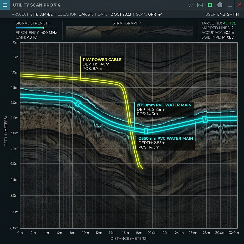
Non-destructive Ground Penetrating Radar (GPR) services to trace pipes, cables, and conduits. Prevent costly strikes, damage, and excavation project delays.
Civil excavation, architectural digging, and plant expansions face extreme risk from underground utilities. Striking a water main, high-voltage cable, or fiber optic trunk can halt works, cost millions in fines, and threaten lives. TerraX3D provides advanced Subsurface Utility Engineering (SUE) services to map under-surface conditions before you break ground.
We deploy advanced dual-frequency GPR systems to locate both metallic and non-metallic utilities (concrete, PVC, clay, and fiber).
Precision electromagnetic locators (EML) detect live power cables and metallic pipelines, tracing structural feeds back to coordinates.
Our geomatics and utility tracking specialists map subsurface structures according to international SUE standards, classifying features from Quality Levels D to A:
Identify high-voltage power feeds, gas lines, and high-pressure water mains before mechanical excavation begins.
Map existing lines accurately to design new foundations, sewers, or cabling paths around existing paths.
Upgrade municipal maps and site assets with accurate, real-world coordinate measurements.
Verify boundary lines and ground heights with our topographical surveying and geomatics services.
Explore Geomatics →