Industries We Serve
Providing custom geomatics mapping, GPR utility location, and high-density 3D spatial modeling tailored to the unique operational constraints of industrial projects.
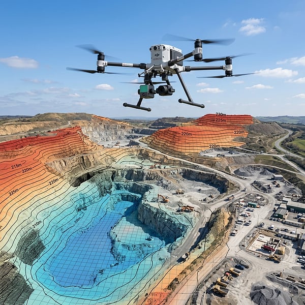
Mining & Resources
Mine management requires strict, frequent stock auditing and high-fidelity elevation coordinates to manage excavation and bulk inventory. TerraX3D delivers drone volumetric surveys and stockpile calculations for coal, ore, and quarry minerals. We map high-accuracy DTMs of pits and haul roads to ensure grading compliance.
Mine Stockpile & Haul Road Audits
Volumetric tracking, pit contours, and excavation boundary alignment.
Strike Prevention & As-Built Verification
Pre-construction utility tracing, concrete rebar scanning, and clash audits.
Civil Engineering & Construction
Utility strikes during civil excavation lead to costly damage, safety threats, and project delays. We perform non-destructive Ground Penetrating Radar (GPR) scans to trace buried pipes, cables, and conduits, transferring coordinates straight to structural CAD models.
Energy & Utilities (Powerlines)
Electrical utility corridors demand systematic monitoring to analyze wire sag, line clearances, and vegetation encroachment. We deploy drone LiDAR scanning to pierce canopies and generate dense point cloud structural profiles of transmission corridors.
Transmission Corridor Encroachment
Vegetation clearance calculations, conductor sag checks, and tower alignment.
Reinforcement Steel & PT Cable Location
Locating reinforcement structures inside slabs to prevent coring accidents.
Concrete & Structural Coring
Prevent accidents and structural failures during drilling, coring, or cutting operations. We provide high-frequency slab scanning to locate rebar, tension cables, and conduits inside concrete structures, transferring accurate depth charts to site managers.
Frequently Asked Questions
Get answers to common inquiries about the industries we serve and spatial data sectors.
Need Industry-Specific Spatial Coordinates?
Get in touch with our surveyors and spatial engineers to discuss your sector requirements. We formulate custom estimates aligned with your specifications.