LiDAR Scanning & Modeling

LiDAR & 3D Spatial Solutions

High-density aerial and terrestrial laser scanning producing millimeter-grade coordinate accuracy. We generate rich 3D point clouds, topographic surface profiles, vegetation management surveys, and digital twins.
Book a LiDAR Survey
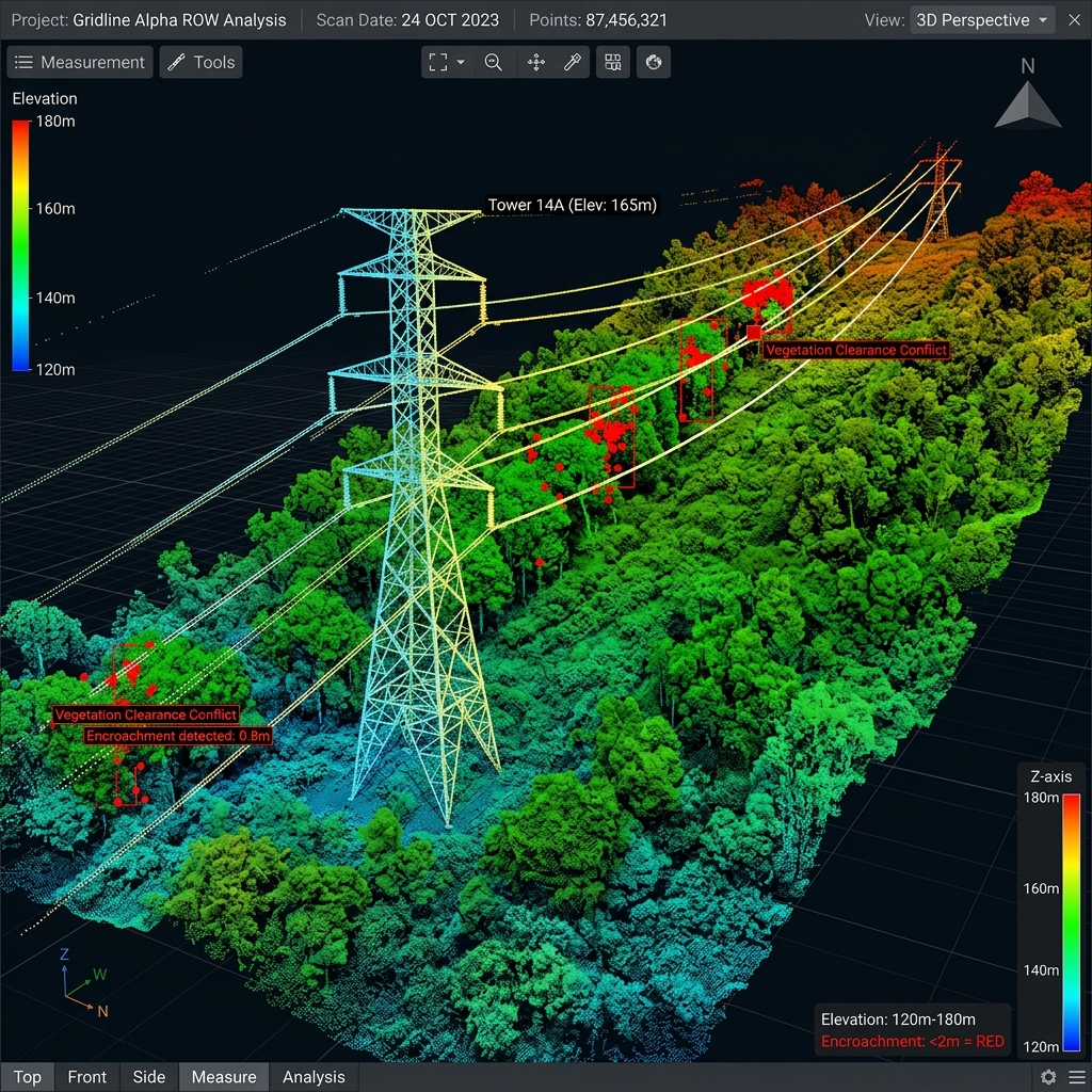
High-density 3D LiDAR point cloud scan of utility transmission towers

Dense 3D Point Clouds & As-Built Digital Twins

B2B infrastructure management, power transmission, and civil engineering projects demand absolute visual and structural accuracy. TerraX3D utilizes state-of-the-art Light Detection and Ranging (LiDAR) sensors. Unlike traditional photography, our active laser scanning pierces dense tree canopies, vegetation, and atmospheric layers to capture exact ground coordinates.

Transmission Line LiDAR Mapping

Fast, high-fidelity mapping of utility corridors. We identify wire sag, utility tower deformations, and calculate vegetation encroachment clearances.

3D Point Cloud Generation

Millions of accurate 3D points matching XYZ coordinate parameters, providing millimetric reference files for BIM pipelines and CAD design overlays.

LiDAR Deliverables & Integrations

We deliver cleaned, classified datasets ready to import directly into your structural engineering workflows:

  • Classified LAS/LAZ Point Clouds: Separated into ground, vegetation, structures, and conductors.
  • DEM and DTM Datasets: Digital Elevation Models and Digital Terrain Models mapping the precise bare earth topography.
  • Scan-to-BIM Revit Files: High-precision structural meshes detailing as-built steel configurations and concrete layers.

Advanced Capabilities

Vegetation Penetration

Our high-end LiDAR sensors record multiple pulse returns to scan right through leaves and branches, plotting ground details.

Deformation Analysis

Compare sequential scans to identify millimeters of concrete settling, retaining wall shifts, or steel warps.

GIS & CAD Ready

Seamless integration with civil spatial platforms. Standard coordinate mapping (WGS84, Hartebeesthoek94).

Need Subsurface Locating?

Complete your B2B pre-construction survey with GPR scanning to maps underground conduits and avoid utility strikes.

Explore Subsurface →